More Kawartha Lakes Road Closures With Continued Flood Watch!
Kawartha Conservation Authorities advised us Kawartha Lakes Flood Watch will be in effect over the weekend. Are you battening down the hatches? More roads have been added to our 2014 Flood Road Closures Map. How are you keeping a close eye on children when they are outside playing?Also on Kawartha Lakes Mums:
Warm weather and more rainfall are two main factors in the expected big water levels. The message was sent to us on the basis of information received from:
Kawartha Conservation Flood Forecasting Network
Ministry of Natural Resources - Surface Water Monitoring Centre
Environment Canada
Trent-Severn Waterway
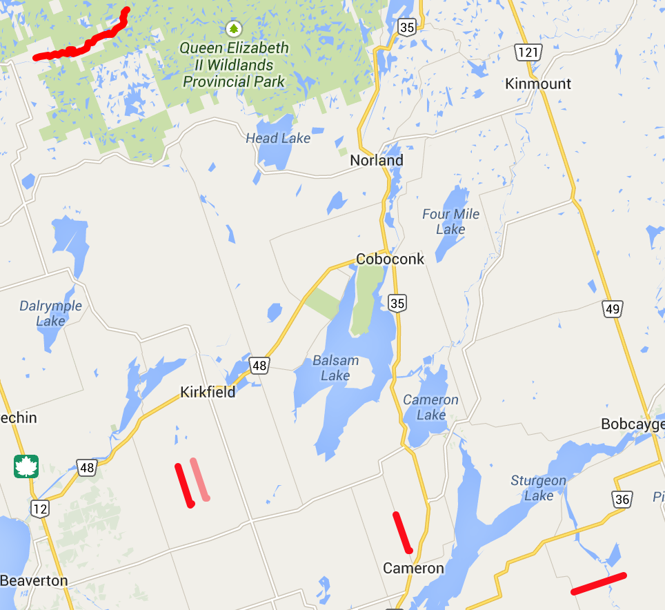
2014 Flooding Closes 5 Kawartha Lakes Roads
 |
| 2014 Kawartha Lakes Flooding Road Closures |
- Cameron Road
- Sandringham Road
- Black River Road
- Kings Wharf Road
- Prospect Road
Would you like to see where these roads are? Just click the picture of the map for an updated interactive map.
Here is the Flood Watch announcement issued by Kawartha Conservation:
Kawartha Conservation Continues Flood Watch Advisory Over Weekend
Kawartha Conservation advises that a Flood Watch remains in effect for the Kawartha Conservation watershed. Local watercourses are flowing at high water levels and greater than usual velocities in response to the runofffrom melting snow and precipitation received earlier this week.
Remnants of the snowpack are still present across the watershed, especially in forested and shadowed areas. Ground surfaces are wet and runoff storage spaces, such as low-lying areas, road ditches, and other ground depressions, are filled with water. The weather forecast calls for air temperature as high as +13 C for the next three days; 5 to 10 mm of rain is predicted for the Kawartha Conservation watershed over the next 24 hours.
Under these weather conditions snow will continue melting. Runoff from snowmelt, coupled with rain and limited storage capacity will maintain elevated water levels and velocities in local rivers and streams. Water accumulation in areas adjacent to watercourses, road ditches, and areas with poor drainage will persist.
All local rivers, streams and lakes will continue to be extremely dangerous. Riverbanks are very slippery and unsafe. Ice cover, where it exists, is weak, unstable and increasingly hazardous. Kawartha Conservation is warning all residents to stay off of ice and away from water bodies, as well as water structures such as bridges, culverts, and dams. Children should be warned of dangerous conditions and caregivers should maintain a close watch on children who are outside.
Municipalities are advised to closely monitor areas known for flooding and be prepared to respond to high water situations as they occur. Residents are advised to contact their municipalities should a flood threat develop. Local municipalities are first to respond to and assist with flood emergencies.
Subscribe to Kawartha Lakes Mums to stay in the loop! Visit us on Kawartha Lakes Mums Facebook Page, Kawartha Mums Twitter, and Check out Kawartha Lakes Mums Youtube for Insider Secrets Note: This unsponsored post contains an ad.fly link to help cover expenses. Find out more at : http://adf.ly/?id=4009826
No comments:
Post a Comment
Thanks for reading!
We look forward to your comments, and will publish them after checking for family-friendliness.
If posting a link, please link back to us, or have a place where we can comment and link back to our blog.
Thanks!